Thursday, December 15, 2011

Goin' Upta Beans

My worn in Bean boots, in front of the giant Bean boot.

     This site is one every self respecting Mainer, northern or southern, should know: LL Beans, or just Beans as the locals call it (honestly, I just realized while looking at their website writing this that there's no s in the name, everyone just calls it Beans). The drive from Portland is not that far, about 20 minutes if traffic's not too bad. Finding a parking spot, even in the Christmas shopping season was really easy, thanks to the large amount of renovations they've done in the area the last few years. The store was really busy, so much so I didn't even bother to try shopping. I wasn't interested either way, I own enough flannel. Every where you went in the store it was totally full of people.

     In the last couple years, as they've opened up smaller related stores (such as as a bicycle store, home store, etc) in the area they've done a lot more to the main store, the "flagship store" as they call it. They put a big boot statue outside, a fish tank inside, and a bunch of smaller exhibits about different products in the stores history. I remember even when I was a kid, not too many years ago, they had the one main store, the factory store down the street, and that was it. Now they have multiple stores, a ton of different departments, all within the last 12 years or so. Judging by their store, they appear to be doing quite well, despite the oft talked about economic downturn.

Historical Significance of LL Bean

     The LL Bean store is in one of the Maine's longest lasting and successful companies, if not literally, it still is in the eyes of most people. Maine and LL Bean go together in many ways. They are economically linked, according to Forbes it is the 259th largest privately owned company in America, and in 2005 made $1.47 billion dollars. They are also culturally linked, as the products of Beans are as big of a part of Maine culture as lobster shacks, trees, and Moxie. Whether it's true or not, a lot of Maine people have the impression that the rest of the country see us all as Bean models, and to some extent it's true (name me one Maine kid who didn't have this backpack as a kid: http://www.llbean.com/llb/shop/62855?feat=816-CL1). A worn pair of Bean boots and a flannel the unofficial Maine uniform for 9 months of the year.
     One way LL Bean is a huge part of Maine culture, and a way I didn't realize until recently, is the amount of jobs it provides. Forbes lists them as employing only 4,300 people, but it seems like much more. It is entirely possible that every resident, if not knowing someone directly, knows someone who knows someone who has worked there, or is working there. I myself can think of plenty of people I know who have been involved there, my own father has worked there for many years longer than I've been alive. I realized this lately while reading about the automotive industry in Michigan. I think it's a fair comparison. The auto industry does provide many more jobs, but Michigan also has more then 9 million more citizens. Just in terms of impact on the areas they are based, I think it's easy to see how similar they are.

Portland Head Light


      The next site visit I did was just a touch more touristy, but had to be done. On a crisp early December morning I made the drive over to Cape Elizabeth to see the worlds view of Maine: Portland Head Light. The Light is part of Fort Williams park, which is an old military fort. When I went it was fairly nice out, but because it was off season there was only about 5 cars parked there. Despite this, the museum was open, but I didn't bring any money to get it. The sign said it was only a couple dollars though, so I'll definitely come back
sometime.

The dog again, at the light.

     The people who were here didn't seem to be tourists, though I must have looked pretty touristy, as an older lady told me about where I could find an off leash area for dogs. I must have looked non-local. The people here seemed like they were from the area though, as they were just here with kids, walking dogs, going running, or walking. The museum store looked fairly vacant.
     The lighthouse was decorated for the season, and had a large wreath hanging off the top. Other than that though, the area wasn't decorated noticeably. The area was still very well kept though, even in the non-tourist season. The area was spotless, and the grass was unnaturally green. There is a really good view of the ocean from here, which makes it easy to see why it is as popular as it is.


Historical Significance of Portland Head Light

     The significance of Portland Head Light, to me at least, is very similar to the significance of Monument Square. It's not it's actual purpose that makes it significant, it's what it has become over time. It is not that it is hundreds of years old, or a necessary part of shipping historically that makes it so significant. It's what it represents about Maine and this area. Whether locals like it or not, this is the image much of the rest of the world has of Maine. When people think of Maine, this lighthouse is what they think of. This image has probably brought more people to visit Maine than anything else. It is a matter of opinion, but I believe more than Moose, Lobster, Bean boots, Moxie, or Longfellow's poetry, that this image represents Maine to most people. If you type in Maine in Google, Portland Head Light is the third picture to come up. It is to Maine as the the arch is to St. Louis, the Statue of Liberty is to New York, or the Eiffel Tower is to Paris.

Monument Square in Portland


A road used to run through this portion until the 70's.
     The next place I went to was Monument Square in Portland. They recently set up the city Christmas/Holiday tree and I went down at night to look at it light up. Every year the city takes a big tree and sets it up in the square. When I went down it was only about 9 at night, but there were few people around, and most of the businesses were closed.
     In addition to the main tree, the city had put lights up on the smaller trees in the area. I seem to remember that the city usually puts lighted balls on the buildings too, though they might have not yet, or maybe I'm thinking of another part of the city. The area is well kept up. However, most of the people passing through seemed a little crazy, but that is generally the nature of Congress Street.
     The monument of Monument Square is a statue dedicated to "Her sons who died for the union." It is officially known as the Soldiers and Sailors monument, and was dedicated in 1891, and is meant to memorialize those who died in the Civil War. The statue is still in great condition, and is one of the more famous Portland landmarks.


The Historical Significance of Monument Square

Square ca. 1950's, showing the old road. From Maine Memory. 
     In addition to the significance of the Civil War monument, Monument Square has been significant to the city as something of a town center. The square is located right in the middle of the down town, and is surrounded by many of Portland's well known buildings. Surrounding it are One City Center, a large office building, the Portland Public (recently renovated), and the famous time and temperature building. The time and temperature building is an image that is synonymous with Portland, as it can be seen from just about anywhere that has a view of the city. It is so named because of the large digital sign on top that goes between listing the time of day and the temperature.
     Monument Square is also a meeting place in the city. There have been many protests there, for the war, economy, religious salvation, and recently it is where the Portland wing of the Occupy movement started off. Though the city eventually compromised with them, letting them instead stay down the road at Lincoln Park. Regardless of the politics of the group, Monument Square has been a meeting place and town center for it's part of Portland for years, and will likely continue.

Tuesday, December 13, 2011

Scarborough Colonial History: Hunnwell House and Massacre Pond


Ca. 1950, from the Maine Memory Network.
For my next two sites I went to two connected sites in my hometown of Scarborough. One of these was the Hunnewell House, the other is Massacre Pond in Prouts Neck. The sign dates the house to 1684, but online I've found a few other dates, all around the same time. I went off season, so I couldn't go inside. I have been inside before, on a field trip as a kid. Outside it looked like the house is being taken care of quite well. The signs says it is a "restoration project," but it looks fairly well restored already, especially when comparing to a picture from the Maine Memory Network of the house in the 1950's. There was no one else there, but even driving by in the summer time I can't recall ever seeing many cars there. One thing I didn't know until a couple years ago was that the house wasn't originally built here. I still haven't really got a good answer for where it was first, I've heard closer to Prouts Neck, but I'm not really sure.


Me looking very colonial.
The next place I went was not far from here down Black Point Road. You follow the same road down to Prouts Neck, to the sign that says Scarborough Beach State Park. There you have to park on the road. During the summer there is parking you can pay for, but during the off season you can park on the street. There was quite a few cars there on this particular day, as the dirt road to the pond also goes to Scarborough Beach. On either side of the road you can see the pond. It was here that two separate Indian attacks happened, one in 1703 killing Richard Hunnewell of the Hunnewell house.


Massacre Pond

Historical Significance of the Hunnewell House and Massacre Pond
     
     The Hunnewell House and Massacre Pond are both very historically significant to the history of Scarborough. The house is probably one of the best ways of telling how the early settlers in Scarborough lived. However, there are still somethings we do not know. It is not fully known if the Honneywell house was a house. It may have been a store, as Hunnewell did own a store. It was a store later on in the mid 1700's, though it's original use is still unknown. Regardless of it's purpose, it is still believed to be the oldest surviving building in Cumberland County.
     The incident at Massacre Pond can tell us a lot about settler and native relationships during this time. What is known about the event was that two months after the start of Queen Anne's War Richard Hunnewell and 18 others were tending their animals at the pond and 200 Indians came out and ambushed them, killing them all. It is an important reminder in a modern town that can often forget it's history. The pond is now most well known as being near the beach, and being good for ice skating, but there are probably many who do not know about the Massacre at Massacre Pond and the losses that occurred to settle the area, on both sides of the settler and Indian wars.

Bradbury Mountain State Park

     The next place I went to on the morning of November 5th, was Bradbury Mountain State Park, in Pownal. I'd been here once before, but not for quite a while. When I got there there was a box at the entrance to put the park fee, which is only a couple dollars.
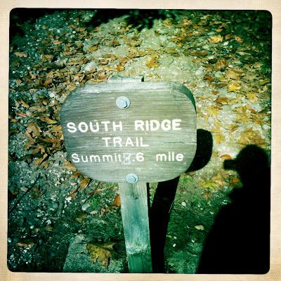
     There are a couple different trails from around the parking area. I took the South Ridge Trail. The trail had some It was one of the longer trails, but still took only half an hour or so to get to the top.
     From the top there is a good view of the area. On this clear day, you could see for a good distance, and see lots of the peak foliage. It's pretty hard to believe it's only half an hour from the states biggest city to get here. The particular day I went there was a pretty good amount of other people hiking too, as it was a pretty warm day.
     I took a different trail to the bottom of the mountain. This trail only took about 10 minutes, it was pretty direct to the parking lot. There was also people getting ready in the parking lot for mountain biking. Apparently most of the paths in the park are also accessible for bikers, but I actually only saw one on the trails.

Dog at the top of Bradbury Mt.

Historical Significance of Bradbury Mountain State Park

     According to the website for the park, it was used for raising grapes by the Cotton family in the 1800's, and apparently you can still see their terraces on the mountain. I must have missed them, or maybe they were on another trail. Their site also says that the area was used to hold stray animals, and in the 20's it was used to mine feldspar for jewelery. In addition to it's land use historically the area is significant for it's park history.

     The park at Bradbury Mountain was one of the first 5 state parks in the state of Maine. In a state that prides itself on it's nature, the fact that one of the first parks in the state (founded in 1939) is still a place many come to visit says a lot about the state. It shows us that much importance is placed on saving land that could have been used to other things, to keep the natural resources of the state intact. In the 90's the park even added land, showing that the interest in keeping Maine's nature secure is still as important as it was when it was first set aside.

Tuesday, November 22, 2011

Civil War Gun Powerder Mill

Instead of a bad picture of me, here's my dog at the mills.

     This site I went to next was the remains of the Gambo Powder Mills. Some of the class took a trip there on Saturday, but I was working Saturday so went the Friday morning before. It was a fairly nice fall day, but there was also a lot of leaves on the ground, which made me almost walk by a few stone structures,but they had signs at them. I had never even heard of these, so it was pretty cool to go and check out a significant Civil War related site a few towns over.

      However, I was expecting the mills to be in better condition. When I first heard there was a mill I wasn't expecting a restored building, but thought there would some building left. There are many older structures around Maine still standing. There wasn't much left but a few foundations and such. It was still interesting to look at, and it would have been interesting to take guided tour, as all I really learned about the site was what was on the signs. There wasn't anyone else there, and it looked like it wasn't really a busy place. 

  
Powder Mills Historical Significance

     The powder mills at Gambo Falls must have played a great significance in the Civil War. It produced a large portion of the gunpowder used by the Union troops.  This would have been been useful to everyone in the Union army, not just the soldiers from Maine. In addition, it would provided jobs to those who stayed back in Maine, and didn't go off to fight. This would have helped the local economy in a time when many of those who were able to work were not around. Due to its dangerous conditions, the mill payed especially high wages, .50 to .75 cents a day more than other jobs in the area. The total pay per day at the end of the war was about $2.50. However, after the war, the demand for the powder declined, and the mill eventually went out of business.

Thursday, November 17, 2011

Cutting Down Elsa


     For my second local landmark, I chose to go to the cutting down of Elsa. This was the giant elm tree that was a fixture of Oak Hill in Scarborough for years. The tree itself was estimated to be about 150-200 years old, but was dying. It also may have had Dutch-Elm disease. The town decided to cut it down either way, and hack it's remains up into various wooden items to raise money for the town.

      On the morning of October 15th, I went to Oak Hill to watch the tree get cut down. There were cranes and other tree felling trucks around. For some reason I was expecting a couple of burly men in flannel to hack at it with an axe until it fell into the road. It took quite a while for them to tie ropes to the tree and bring in a bucket truck with a man with a chainsaw inside. From there they took the tree apart little bits at a time. On the side of the road I was on there was only a few people, mostly local reporters, a town representative, and a couple people from the town public works. On the other side of the road, in the Amato's parking lot, a thrilled group of people watched on the edge of their seats the town provided.
      People seemed a little nostalgic, talking about how the tree had been there as long as they could remember, but people generally just thought of it as a good spectacle to watch. One local reporter interviewed me, which would have been my proof I was there, but alas, I must have been too boring as he didn't use me in the article in the paper. I said something about how I used to drive by the tree on the way to high school and just thought I would come and see it get cut down. I was there for little over an hour before I had to leave, at which point they still had lots to go. When I drove past later there was just a stump left of the old town landmark.

Historical Significance Of Elsa

The historical significance of Elsa isn't anything particularly special. I doubt anyone from Scarborough would even know the tree had a name or anything about it's history. Many people from Scarborough probably never even noticed it. However, the tree dates back to the early 1800's, and was certainly a part of the town for years. That would date it, at most, 100 years before any of my ancestors even came to America. In once sense the tree was significant to the town just for it's age.
Oak Hill in Scarborough ca. 1950, though Elsa would have been to the left of this photo, it still was at least 100 years old at this point in the town's history.


In another sense, the tree is much more a representation of the town's changes through time. Many of the town's old landmarks have gone the same way throughout the years: the abandoned drive-in became a park, the water tower (which was maybe a hundred feet from Elsa) was torn down, Winslow Homer's famous house is gated off, the old greasy spoon that seemed to be built in the fire station parking lot was replaced with a bench, Shop N' Save became Hannaford, etc, etc.. Elsa is just one more former piece of a formerly small town that is changing rapidly. So, at least I think, it's significance is not in anything it did for the town, but as a symbol of a what the town used to be, and is now.

Mt. Blue State Park

View from parking near summit trail.


     For my history of Maine class at USM I have been given the task of visiting places around the state. On October 11th, the first place I went to was Mt. Blue State Park, in the town of Weld, Maine. The area is roughly two hours north of Portland, near the town of Farmington. According to the Maine Bureau of Parks and Land's website, the land was given to the state in 1955. Before this it was ran by the U.S. Department of Agriculture, who acquired the land as a WPA project during the Great Depression.

     However, do to too much antique shopping by myself on the drive up, as well as a refusal to use a GPS took up most of my time getting there. Therefore I didn't have time to climb the summit trail of the mountain before sunset. Should I actually researched the park before going I also would have known the trail was closed for repair. This actually made the trip much more enjoyable. In order to try to find another trail that I did have time to do, I drove many of the dirt roads in the area. Many of these appeared to be current logging roads, with small patches of trees missing. One road had a small cabin that appeared to be very old, but eventually just led to a small church camp, which was very strange in itself. Regardless, it was still very interesting to see a part of the state I have never been.

Dirt road and empty bible camp in the woods.

     Eventually the driving led me to Webb Lake. The area was closed the day before, leaving it empty. I had to park on the side of the road and walk in. The view from the pond was great. You could see all the mountains in the area. It was also great for what you couldn't see. No people, very few houses on the lake, no jet ski's, no Canadians, and no development. You really got a feeling this was true rural Maine, an area that still lived on the land and not in the office. I learned that hope for Maine turning into a giant industrial park or housing development wasn't totally lost (if the gas station still ran by an attendant didn't convince you), you just have to drive 3 hours to see it. Even better, was that due to my own poor management of time I managed to get to the lake at sunset, which was prime for touristy leaf peeping as it was.

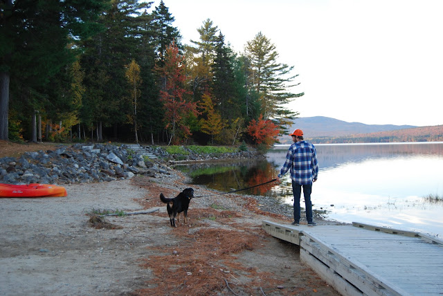
Yours truly with dog truly at Webb Lake.
Webb Lake at sunset.

Historical Significance of Weld, Maine and Mt. Blue State Park.
  
  As said above, Mt. Blue was first purchased by the USDA during the Great Depression. Before becoming the state park, the area was settled around 1800. According to Geo J. Varney’s History of Temple, Weld, and Wilton, Maine (http://history.rays-place.com/me/franklin3.htm) as of 1886, the town was still home to five saw-mills. The area also produced other small items. The area, while not destitute, does not appear to ever have been a particularly thriving town. It was certainly never a Bangor, and certainly isn’t now.
    Then why is this area historically significant? It never had a major factory, never had a population far over a thousand people, never had a particularly famous citizen (in 1886 Varney says the most esteemed citizen is a doctor), had no major tourism industry , and never became super wealthy. I believe that the area is important to the history of Maine for all those exact reasons. It is still very much that way, and for me, who rarely sees Maine out of the greater Portland area, it appears to be the quintessential Maine town. These are the towns that built our state, one small contribution at a time. Small towns, connected by small roads, with houses not set up in neighborhoods, but set back from the road by mile long dirt driveways.
    For me this area gives more representation of how out state was, what attracted people to it, made it once thriving, and how it should stay than most of the places I see day to day around Portland.